Introduction
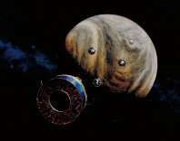
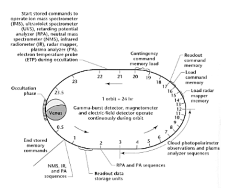
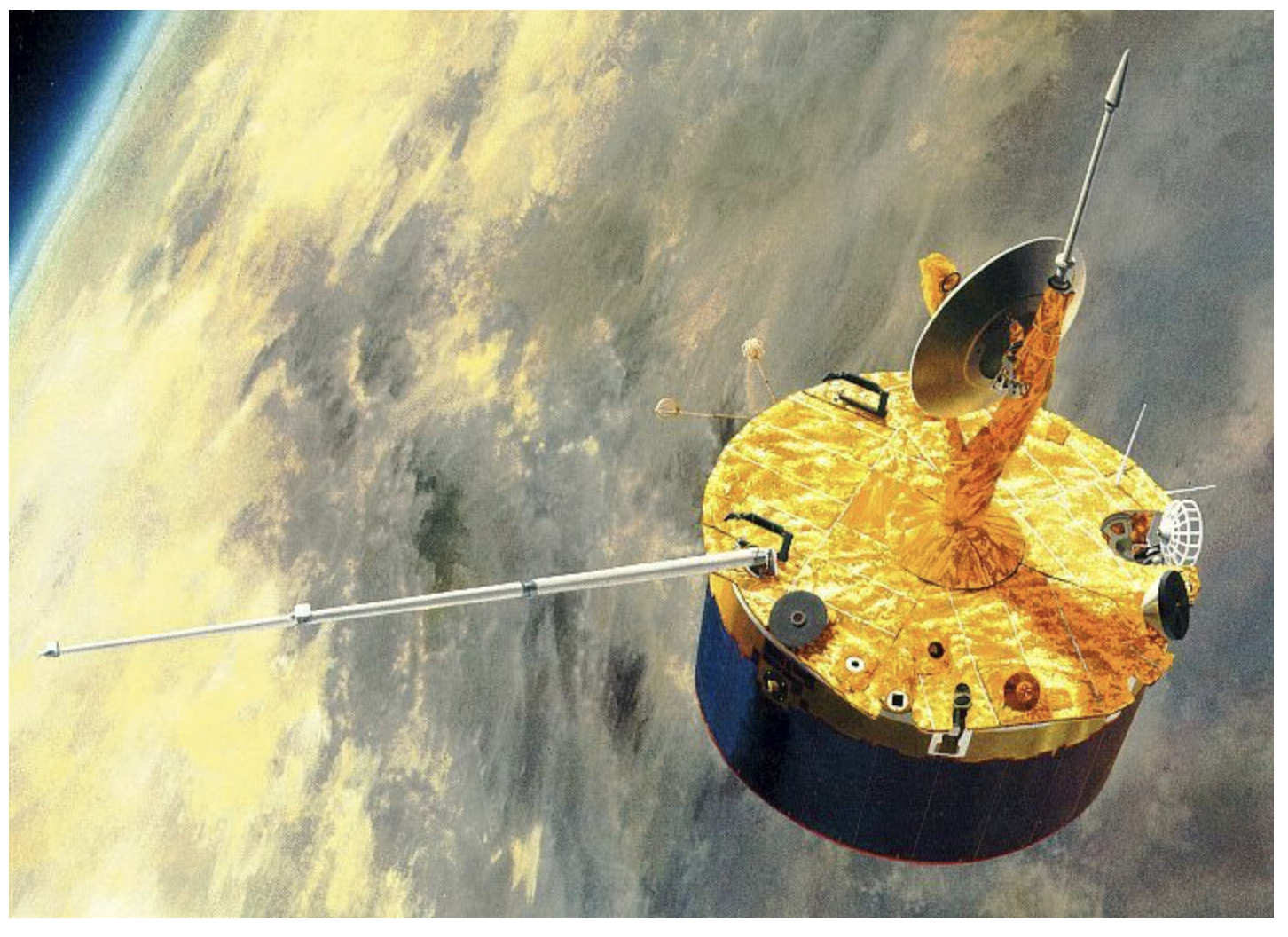
The Pioneer Venus orbiter entered orbit on Dec 4, 1978 and the mission ended Oct 8, 1992. It carried 16 instruments to study plasma interaction with the upper atmosphere, make multi-wavelength observations of the clouds and to map the surface with radar. The UV data contained in this dataset were obtained between 1978 and 1992. Retrieval of this data set was begun years ago, thus ATM has chosen to review it as a PDS3 data set and to do the migration later.
This PVOUVS dataset spans the tie from 1978-12-05 to 1992-10-07 and consists of 7476 caibrated fie plus supporting data. Thus it provides a mission-long set of observational data at several far-UV and near-UV wavelengths associated with day and night airglow emissions and with reflected sunlight. All Venus phases are sampled, as are all levels of solar activity during 1978-1992.
Reference
Stewart, A. I., D. E. Anderson, Jr., L. W. Esposito, and C. A. Barth, 1979, "Ultraviolet Spectrometry of Venus: Initial Results from the Pioneer Venus Orbiter', Science, 203, 777-779
Stewart, A. I. F., 1980, "Design and Operation of the Pioneer Venus Orbiter Ultraviolet Spectrometer', I. E. E. E. Trans. on Geosci. Remote Sensing, GE-18, 65-70 transactions on Geoscience and Remote Sensing, GE-18, 65-70, 1980.
Esposito, L. W., J. R. Winick, and A. I. Stewart, 1979, "Sulfur Dioxide in the Venus Atmosphere: Distribution and Implications', Geophys. Res. Lett., 6, 601-604
Esposito, J. W., M. Copley, R Echert, L. Gates, A. I. L. Stewart, H. Worden, 1988, “Sulfur Dioxide at the Venus Cloud Tops”, JGR, 91, 5267-5276.
Stewart, A. I. F., J.-C. Gerard, D. W. Rusch, and S. W. Bougher,1980, "Morphology of the Venus Ultraviolet Night Airglow", J. Geophys. Res., 85, 7861-7870 Knollenberg, R., L. Travis, M
Accessing the Data
PVOUVS Bundle
Aareadme file
Mission description
Spacecraft description
Ultraviolet spectrometer description
Documents
Data
Calibrated data
The observational data contained in the Telemetry (TM) data products have been corrected for non-linearity of the detector efficiency and have been converted from Counts to radiance units (i.e.,Wm−2 sr−1) and spectral radiance units (Wm−2 sr−1 nm−1). The data contained within this dataset represent a preliminary calibration of the raw data returned by the OUVS instrument using the laboratory calibration curves (see CALIB directory). The sensitivity of the instrument has been shown by Esposito et al 1988 to have decreased with time. Furthermore, the rate of this loss of sensitivity was also shown to be wavelength dependent. Use of data from observations made later than the first roughly 500 days of the mission must take into account this decay in instrument sensitivity. Measurement uncertainties have been calculated for each observation that take into account the precision of the measurement after on-board compression, and the uncertainties in the calibration, but not the potential variation in instrument sensitivity. These data products are equivalent to CODMAC Level 2 (NASA Level 1A) data products.
The Calibrated data products also contain wavelength registration arrays (that is, the wavelength and bandwidth of the observations, calculated from the spectral calibration described in the DOCS/PVOUVS_Calibration.pdf document, using the SOFTWARE/pvouvs_get_waves.pro software), the radiometrically calibrated data array of the observations and its observational error (both calculated according to the DOCS/PVOUVS_Calibration.pdf document, using the SOFTWARE/pvouvs_calibrated.pro software), and the calibration factor array itself (the calculated values used to convert the raw data to radiometrically calibrated data, preserved to facilitate future corrective re-calibrations of the raw data).
The data contained within this data
See dataset_cal
See CAL log
GEO data
The observational geometry information found in the GEO data products have been derived from a combination of the OA and the TM data products The OA data products provide the orbital geometries of the Sun, Venus, and OUVS; while the TM data products provide the orientation of the OUVS instrument. The pointing vector or the view direction of the OUVS instrument is calculated from the known orientation of the instrument on the spacecraft bus (306° from the spacecraft +𝑋-axis), the orientation of the spin (𝑍) axis of the spacecraft, the timing of the specific spatial reference pulse, the reported delay following the reference pulse before the start of data acquisition, the integration period of the photodetector (all from the returned telemetry data), and the location of the spacecraft in the Venus-centered geometry (interpolated to the telemetry data time stamps from the orbit attitude data). Venus is assumed to be a sphere with a radius of 6126 km centered on the planet center (i.e., a reference altitude of 75 km is assumed, plus a solid body radius of 6051 km). The first intersection of this pointing vector with this sphere defines the observed geometry for Venus. The magnitude of this pointing vector is defined as the “slant distance.” If the pointing vector is not found to intersect the planet, then NULL is returned by the code for all planetocentric angles (i.e., longitude, latitude, emission, incidence, etc.), and the Limb Altitude (LimbAlt) is calculated as the altitude above the reference Venus radius at the closest approach of the boresight ray to the planet. When the boresight ray does intersect the sphere defined by the reference radius, LimbAlt is assigned the value NULL.
The GEO data products contain solar latitude and longitude, defined such that the subsolar point is 0◦ in each dimension, the morning terminator is located at 90° longitude, midnight at 180° longitude, and the evening terminator at 270° longitude. The data products also contain the emission angle of the observed point relative to the spacecraft (always ≤90°), the solar incidence angle (values >90° are in shadow), the azimuth angle (range 0° to 180°), and the phase angle of the spacecraft relative to the Sun, where 0° indicates a view of the subsolar point, and 180° indicates a view of the antisolar point. The astronomical right ascension and declination of the boresight are included, as well as the spacecraft (𝑥, 𝑦, 𝑧) position and velocity in planetocentric coordinates, interpolated from the Orbit Attitude (OA) data products, as well as the vector from the spacecraft to the Sun in the same system, also interpolated from the Orbit Attitude (OA) data products.
See dataset_geo
See GEO log
OA data
The OA data contain a summary record that contains the orbit number of the data product, the calendar date and time at the start and end of the data stream, the date and time of the most recent periapse passage, and the date and time of the filo b t creation. The summary record also includes a designation for the level of data processing, an unknown integer value and the number of records contained within the file. The OA data products contain a number of records at specified UTC dates and times of the spacecraft (𝑥, 𝑦, 𝑧) position and velocity in the VCO frame, the spacecraft-to-Sun vector in the same frame, the nine elements of a 3 × 3 transformation matrix to convert from VCO coordinates to Ecliptic Coordinates, the roll angle and the spin rate of the spacecraft, and two integers the meaning of which we have not been able to decipher. More detailed descriptions can be found in the OA Data Labels. These data products are equivalent to CODMAC Level 1 (NASA Level 0) data products.
See dataset_oa
See OA log
TM data
The TM data contain a summary record containing the same elements of information as in the OA data, but as they pertain to the TM data product. The TM data products contain a number of records at specified UTC dates and times of several key parameters. The most relevant of these for the analysis of the spacecraft data include the Roll Index Pulse (RIP) value (used to dictate observational timing), the commands sent to the instrument (used to dictate the observing sequence), a list of flags indicating the status of various spacecraft elements (many of these are extracted from the initial commands, some are diagnostic of spacecraft performance). Note that there sometimes were discrepancies between the commanded actions and what was actually carried out by the spacecraft. There would have been numerous possible reasons for this, such as a loss of information during upload, or temporary mechanical failures on board the spacecraft or instrument. A thorough description of the contents of the TM data products can be found in their labels. In addition to this housekeeping and command information, the raw observational data, measured in Counts is also found in the TM data products.
See See dataset_tm
See TM log
Calibration of f and g channels
Citation
PDS recommendations for citing data sets can be found here.
McGouldrick, K., PVOUVS Data Archive: Telemetry, PVO-V-OUVS-2-EDR-V1.0, NASA Planetary Data System, 2025, https://doi.org/10.17189/k490-ny72.
McGouldrick, K., PVOUVS Data Archive: Orbit Attitude, PVO-V-OUVS-2-SEDR-V1.0, NASA Planetary Data System, 2025, https://doi.org/10.17189/wqr9-6084.
McGouldrick, K., PVOUVS Data Archive: Calibrated Data, PVO-V-OUVS-3-EDR-V1.0, NASA Planetary Data System, 2025, https://doi.org/10.17189/afgq-t544.
McGouldrick, K., PVOUVS Data Archive: Observational Geometry, PVO-V-OUVS-5-SEDR-V1.0, NASA Planetary Data System, 2025, https://doi.org/10.17189/xa0c-er30.
 PDS: The Planetary Atmospheres Node


