
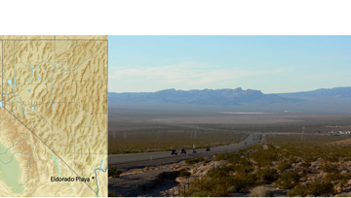
Eldorado Playa (35°52.211′N 114°55.975′W)
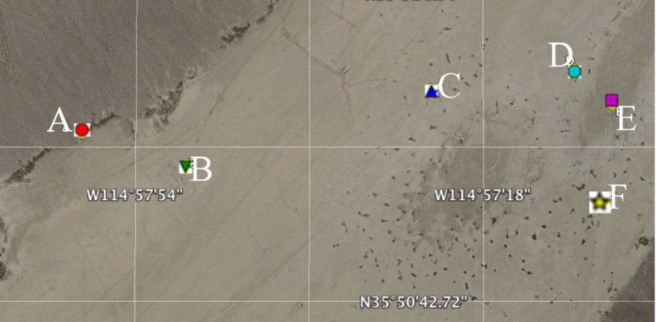
Google Earth map of the playa, with station locations marked.
Introduction
Small-scale convective vortices, of which dust devils represent a sub-set, register in meteorological time-series – winds, pressures, temperatures – collected both on Earth and on Mars. They generally appear as significant, short (few to tens of seconds) outliers in any of these kinds of time-series. In pressure time-series, for example, they appear as negative dips (usually < 1% of the background value), roughly symmetric in time.
The Data
This meteorological dataset consists of pressure and temperate measures as a function of time in the remote region of ElDorado Playa just south of Boulder City NV (35°52.211′N 114°55.975′W) over the course of about 2 years. 15 loggers were deployed at 6 locations in the playa (See above) and data was recorded as ASCII tables on 2 GB microSD flash memory cards. The following table summarizes the acquired data.
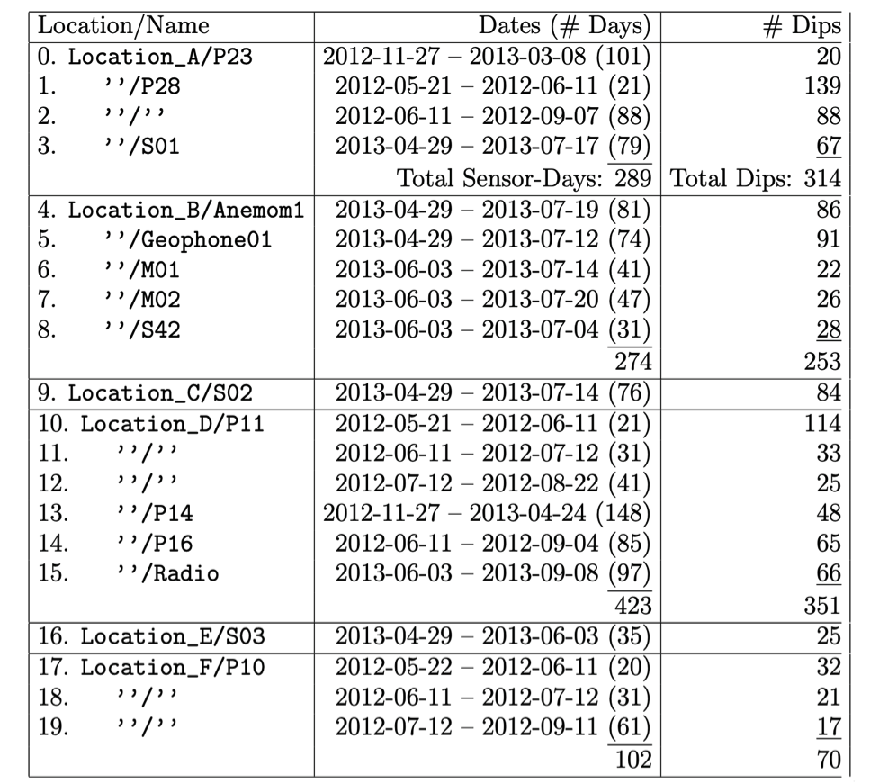
Sensor record location and name, the dates and total days active, latitude/longitude, and total number of pressure dips detected.
Retrieval of the data
The data is in the form of ASCII-format CSV files with XML labels.
Accessing the data bundle
Documentation
Accessing the data at the file level
Citing datasets for publication
Jackson, B. & Lorenz, R. (2021) Dust Devil Field Study in El Dorado Valley, Nevada, Jackson and Lorenz, 2015, NASA Planetary Data System, https://doi.org/10.17189/1h1n-mw72.
Selection by inserting a list of URNs
Download Compressed bundle
