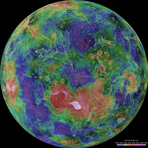
- Obtain near-global radar images of the Venusian surface with a resolution equivalent to optical imaging of 1.0 km resolution.
- Obtain a near-global topographic map with 50 km spatial and 100 m vertical resolution
- Obtain near-global gravity field data with 700 km resolution and two to three milligals of accuracy.
- Develop an understanding of the geological structure of the planet, including its density distribution and dynamics

Introduction
Launched May 4, 1989, Magellan, a Venus radar mapper, was the first spacecraft to be launched by the space shuttle. The main instrumentation consisted of a system that functioned in 3 modes: synthetic aperture radar (SAR), altimetry(ALT), and radiometry used to characterize the surface temperature (RAD).
The Magellan spacecraft was inserted into a near-polar elliptical orbit (85.5o inclination) with a periapsis altitude of 294 km at 9.5 deg. N. on August 10, 1990. By Sept 15. 1990 it was returning radar images. By May 15 Magellan had mapped 83.7% of the venusian surface. A second mapping cycle, ending Jan 15, 1002 added coverage up to 96% and a third ending Sept 13 raised the coverage to 98%.
Gravimetric data was collected during the fourth, fifth and sixth cycles that ended May 23, 1993, Aug. 29, 1994, and Oct. 13, 1994 respectively . On Oct 13, 1994 the craft entered the venusian atmosphere. At the end of cycle 4 aerobraking was used to lower and circularize the orbit to obtain higher quality gravimetric data.
Objectives of the mission included:
In addition to the radar data, information concerning the structure of the atmosphere was acquired via radio occultations. The first set of experiments was carried out on Oct 5 & 6, 1991. Others followed in 1992 and 1994.
Publications
R.S. Saunders, et al., Magellan Mission Summary. JGR, VOL. 97, NO. E8, Pages 13,067-13,090, Aug 25, 1992.
Access to Data
Radio Occultation data is available at the Atmospheric Sciences Node and at the PPI Node
Synthetic aperture radar (SAR), altimetry(ALT), and radiometry (RAD) data are available at the Geosciences Node.
Synthetic aperture radar (SAR) data is available at the Cartography and Imaging Node
 PDS: The Planetary Atmospheres Node


