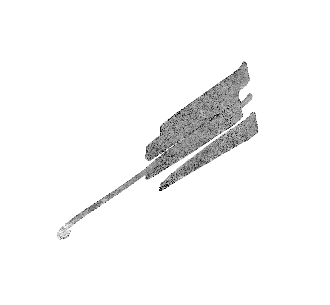
| Northern mid-latitudes (Ganesa Macula, cryovolcanism) |
| Range: 1200km (746mi) |
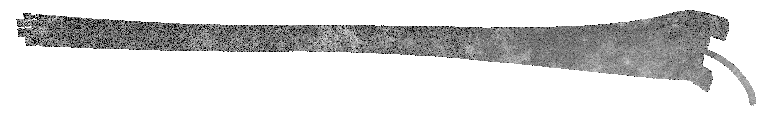 |
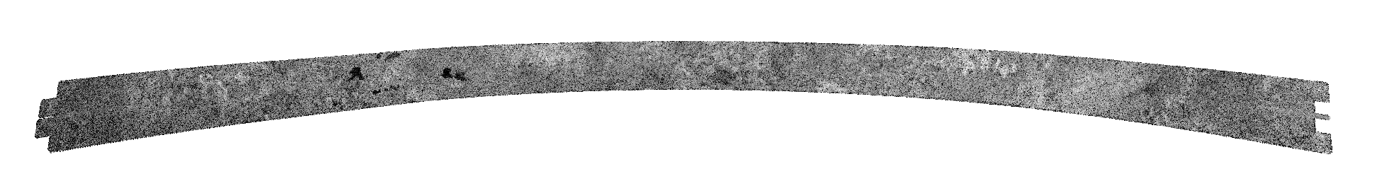
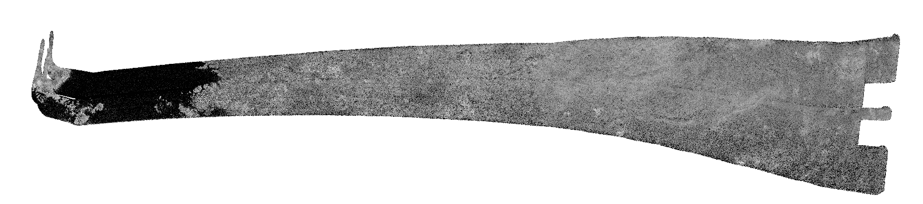
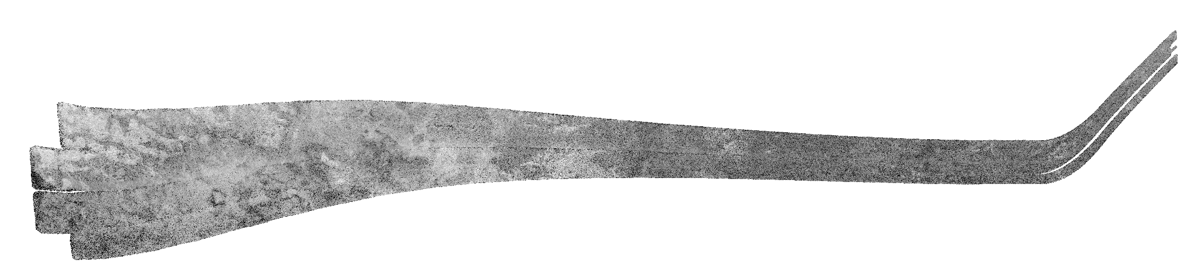
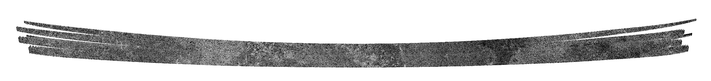
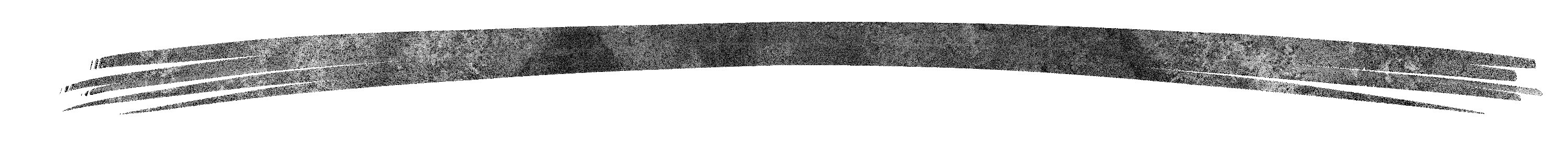
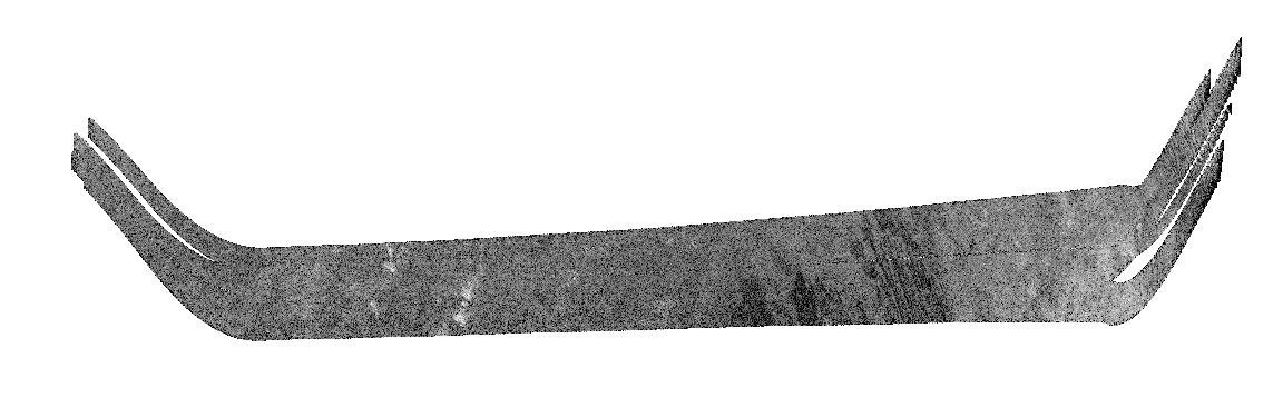
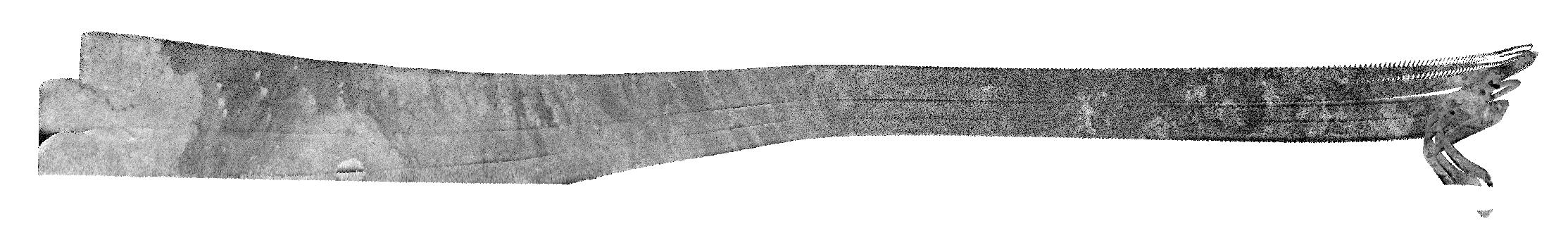
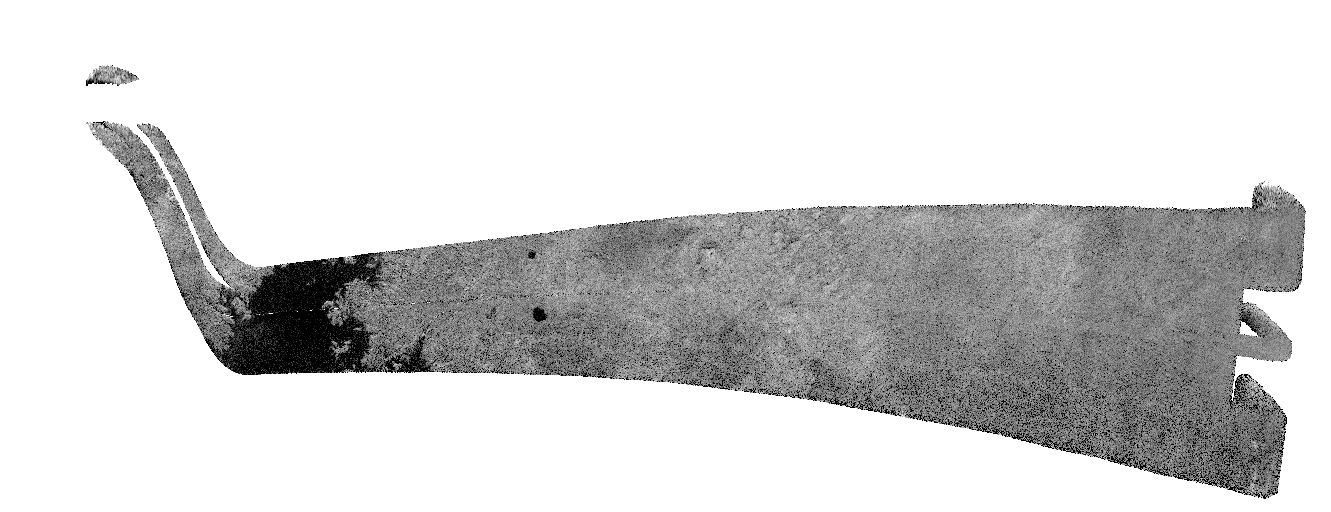
| The Ta pass consisted of inbound scatterometry and radiometry, INMS ride-along SAR and SAR imaging, followed by outbound altimetry, scatterometry and radiometry. The Ta SAR swath crosses the mid-northern latitudes in an approximately E-W direction, from ~32 degrees N, 130 degrees W to 53 degrees N, 10 degrees W. Ganesa Macula, initially thought to be a massive cryovolcanic dome (Elachi et al. 2005b, Lopes et al. 2007a), an interpretation which has since been revised, features radar-bright lobate features, and two circular features with associated lobate deposits are located in the swath. All of these features are interpreted to be superposed on the surrounding plains units (Lopes et al. 2010). Channels interpreted to be fluvial in origin also are located throughout the swath, along with small, isolated hills (Elachi et al. 2005b, Stofan et al. 2006).
|
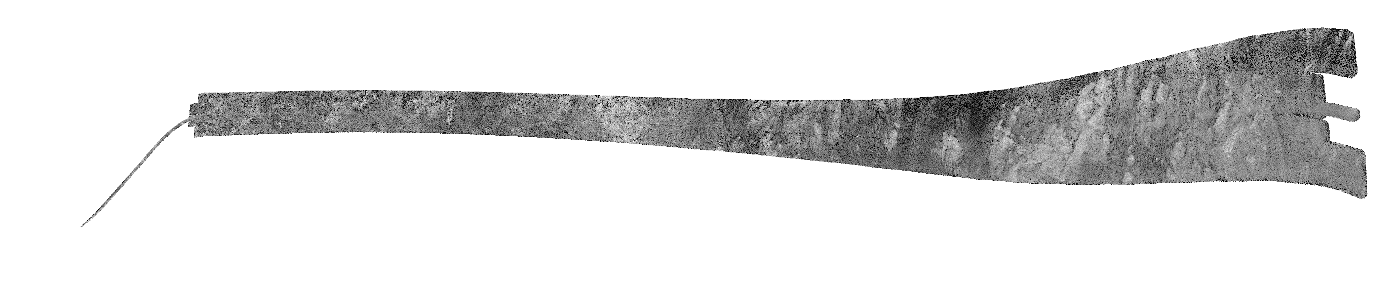
| Northern mid-latitudes (Northern Xanadu, Menrva, Omacatl Macula, Northeastern Fensal, Sinlap) |
| Range: 1577km (980mi) |
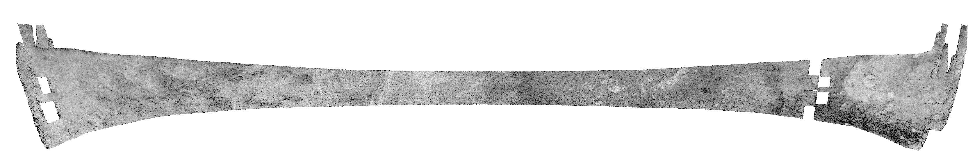 |
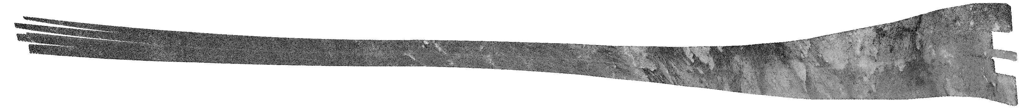
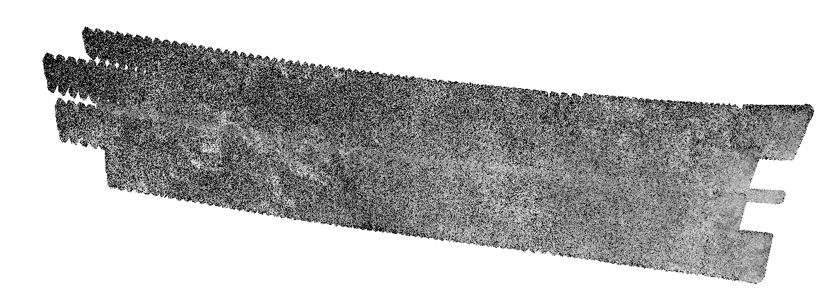
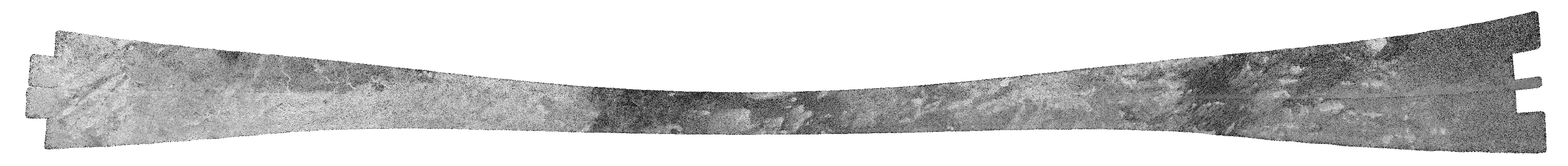
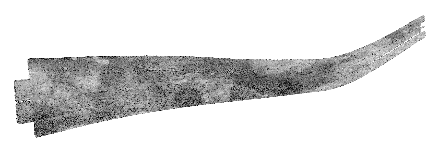
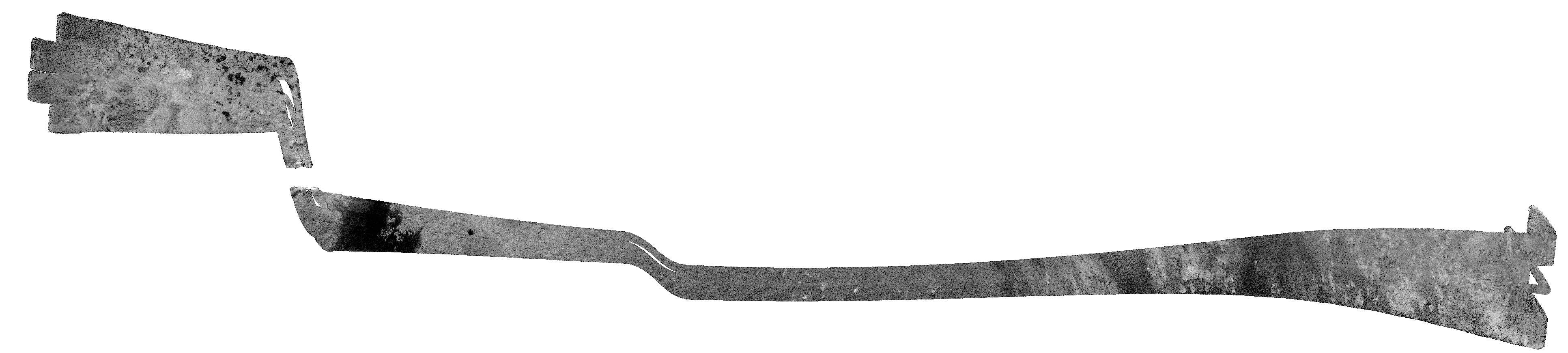
| T3 had inbound and outbound altimetry along with SAR imaging. The T3 SAR swath is located in the low northern latitudes in an ~E-W direction, from 3 degrees S, 0.4 degrees W to 22.5 degrees N, 133 degrees W (Elachi et al. 2006a). Abundant dunes are located throughout the swath, along with two impact craters: Menrva (~450 km diameter, 19.6 degrees N, 87.1 degrees W) and Sinlap (~70 km diameter, 11.3 degrees N, 16.1 degrees W). The dune fields in T3 are superposed on both intermediate and low backscatter plains. Isolated hills are also seen in the swath between 16-21 degrees N and 39-54 degrees W and between 1-11 degrees N and 10 degrees and 23 degrees W, with small circular features of unknown origin near 15 degrees N, 33 degrees W. Fluvial channels-including the wide anabranching network Elivagar Flunima and a few small features interpreted as cryovolcanic flows (Lopes et al. 2007a) are also seen. Principal results of T3 were discussed in Elachi et al. (2006a). An early discussion of Titan craters is in Lorenz et al. (2007).
|
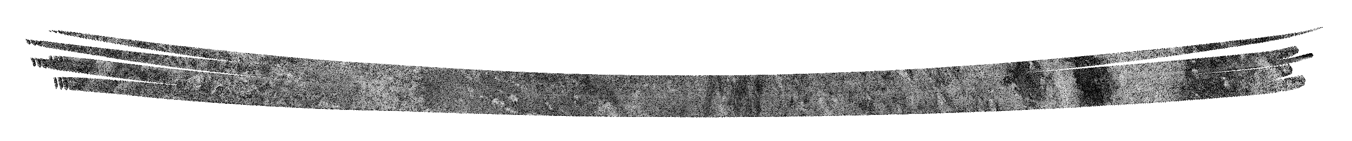
| Southern Mid-latitudes (Central Tsegihi, Mezzoramia) |
| Range: 1075km (668mi) |
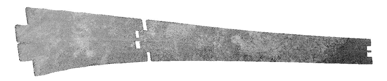 |
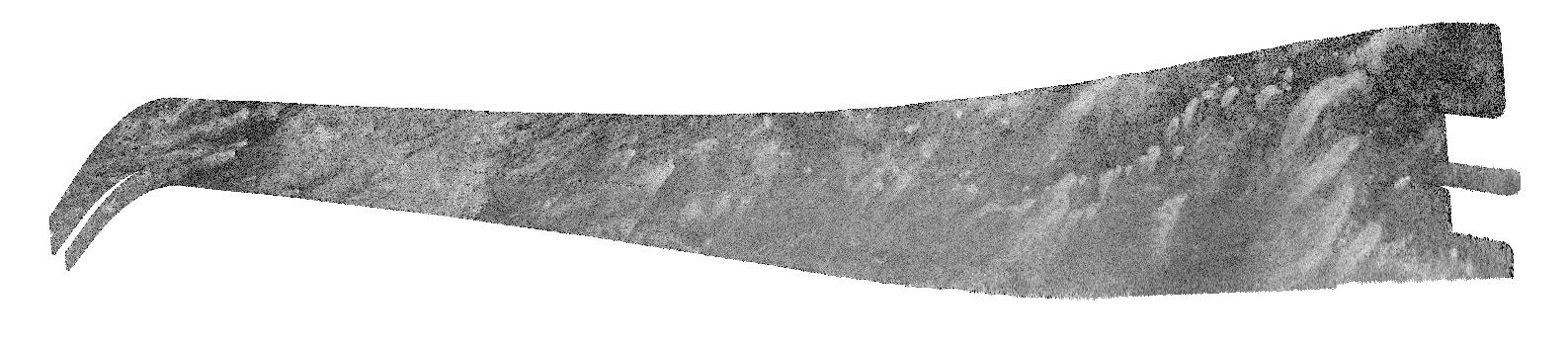
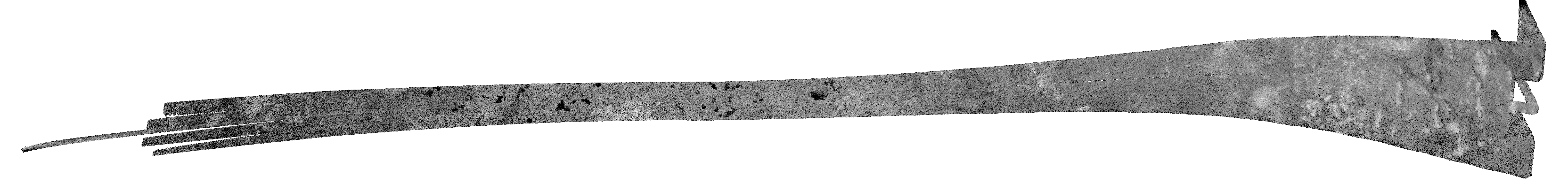
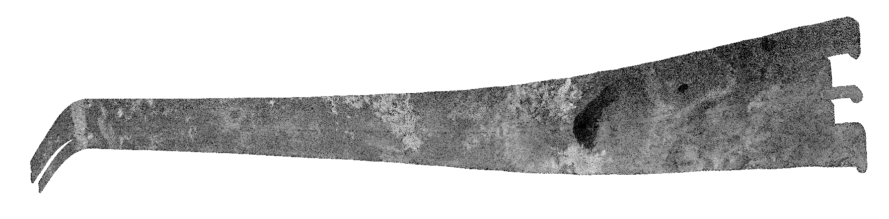
| The plan for T7 was to collect inbound and outbound radiometry and altimetry, with SAR imaging near closest approach. T7 SAR is a partial swath extending from 31 degrees S, 23 degrees W to 70 degrees S, 11 degrees E. Channels are ubiquitous throughout the swath, but are particularly concentrated in the intermediate to bright unit in the swath center that terminates abruptly into a relatively radar-dark unit. A circular feature in the eastern portion of the swath appears to be an eroded impact crater. Results of T7 and T8 are discussed primarily in Lunine et al. (2008).
|
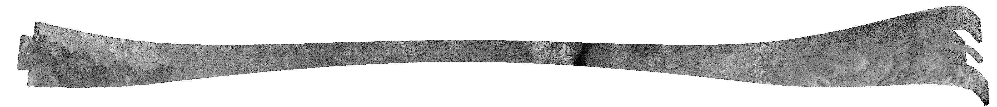
| Equatorial Pass (Trailing hemisphere, Central Adiri, Central Belet, Huygens Landing Site, Antillia Faculae) |
| Range: 1353km (841mi) |
 |
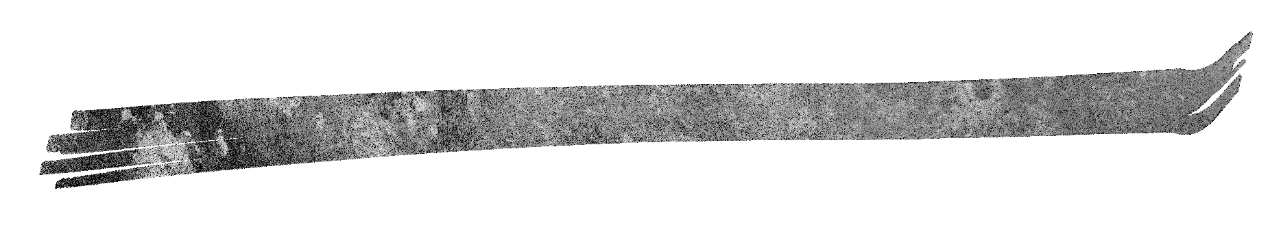
| The T8 pass consists of inbound radiometry, scatterometry, altimetry, and SAR imaging, and then outbound radiometry, scatterometry, and altimetry. The T8 SAR swath, covering the equatorial region, has closely spaced dunes that cover much of the swath and led to the secure recognition of these features (see, e.g., Lorenz et al. 2006b). Linear mountain ranges extend from 13-5 degrees S and 198-225 degrees W (e.g., Radebaugh et al. 2008). A few channels interpreted to be fluvial in origin are seen, as well as small circular features of unknown origin. By design, T8 also imaged the Huygens landing site with radar for the first time.
|
| Equatorial Pass (Leading hemisphere, Central Xanadu, Eastern Shangri-la, Guabonito, Shikoku Facula) |
| Range: 1855km (1153mi) |
 |
| The T13 pass included HiSAR and SAR, along with outbound altimetry, scatterometry, and radiometry. The T13 SAR swath includes the central portion of Xanadu (from 10 degrees S, 65 degrees W to 12 degrees S, 170 degrees W), essentially equatorial, like T8. The Xanadu radar-bright terrain has a "crinkled," hummocky texture and a rugged surface cut by channels, and is characterized by irregular but not regionally raised topography (Radebaugh et al. 2010). Some circular features within Xanadu might be eroded impact craters (Wood et al. 2010). The plains adjacent to Xanadu have abundant dunes. Also to the west of Xanadu is Guabonito, an 80 km-across possibly-eroded impact basin (Wood et al. 2010, Lopes et al. 2010). A T13 HiSAR observation included the Huygens landing site.
|
| North Polar Pass (Northern Lakes Region, Northern Aaru) |
| Range: 950km (590mi) |
 |
| T16 had inbound radiometry, scatterometry, and altimetry; SAR; then outbound altimetry. The T16 swath, the first obtained in the north-polar region, has scattered lakes north of about 70 degrees N (Stofan et al. 2006, Hayes et al. 2008a). Some lakes are only partially filled with dark material interpreted to be liquid hydrocarbons (Stofan et al. 2006, Lopes et al. 2007b), while other basin-shaped features without dark fill are interpreted as empty lakes (e.g., Hayes et al. 2008a). Channels are seen across the swath, along with some small hills, radar-bright patches. Dunes are located only at the southern end of T16.
|
| Short, ride-along pass (Western and central Fensal, Ksa crater) |
| Range: 1000km (621mi) |
 |
| T17 was a SAR ride-along with INMS. T17 is a partial swath containing the impact crater Ksa (29 km) (Wood et al. 2010). The swath also covers part of the Fensal sand sea dunes (e.g., Radebaugh et al. 2008).
|
| Short, ride-along pass (High Northern latitudes, Northern lakes region) |
| Range: 960km (597mi) |
 |
| T18 was an INMS ride-along, SAR only. T18 extends over the north-polar lakes area, providing the second opportunity to images the polar lakes discovered (Stofan et al. 2006) during the T16 pass, extending the coverage. The southern portions of the swath have mottled plains, few channels and no dunes.
|
| North Polar Pass (Northern Lakes Region, Aaru) |
| Range: 980km (609mi) |
 |
| T19 had inbound and outbound radiometry, scatterometry and altimetry, along with SAR imaging. The SAR swath extends from 2 degrees S, 318 degrees W to 42 degrees N, 160 degrees W, over the northern lake district. Bright, featureless patches occur throughout the swath, as well as dunes in the southernmost extent of the swath. Channels are seen throughout the region, particularly in association with the lakes. Some circular features of unknown origin are seen (Wood et al. 2010).
|
| Short, ride-along pass (Belet) |
| Range: 1000km (621mi) |
 |
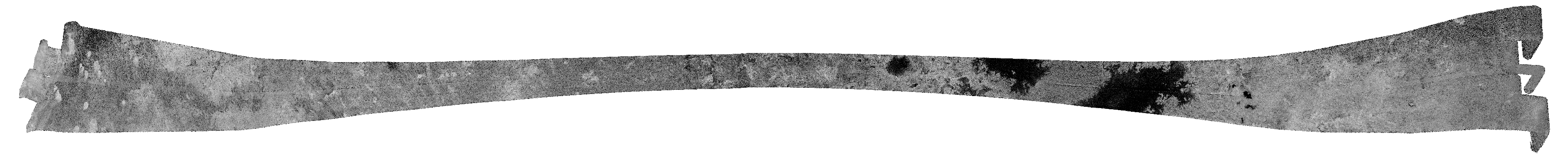
| T21 was an INMS ride-along, with SAR, and outbound altimetry, scatterometry and radiometry. The T21 swath, 25 degrees S, 290 degrees W to 50 degrees N, 195 degrees W, is mostly characterized by dark, relatively featureless plains, scattered bright patches, dunes and streaks. Linear mountains with interspersed dunes cover about half the swath. A number of circular features of unknown origin are defined by a faint bright ring (Wood et al. 2010).
|
| Northern mid-latitudes to equator (Ganesa Macula, Aaru, western Senkyo, Tsegihi) |
| Range: 1000km (621mi) |
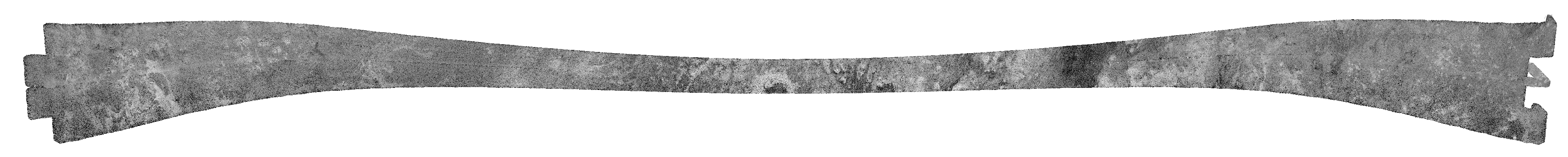 |
| T23 SAR was accompanied by inbound and outbound altimetry, scatterometry and radiometry. T23 contains a region of overlap with the Ta swath, including Ganesha. Also in the swath are abundant dunes, channels, and hills, the northern part of a bright flow, and a partial circular feature with morphology similar to that of Guabonito.
|
| Northern Polar Region (Northern Lakes district, Northern Seas, Shiwanni Virgae, Fensal, Aztlan, Western Quivira) |
| Range: 1000km (621mi) |
 |
| T25 was a full Radar pass, with inbound and outbound radiometry, scatterometry, and altimetry, along with SAR imaging. The T25 SAR swath, located in the mid northern latitudes, has a possible cryovolcanic feature at 15 degrees S, 40 degrees W (Sotra Facula), surrounded by lobate deposits (Lopes et al. 2013.). The swath also is characterized by linear hills surrounded by fields of dunes, and some circular features that may be of impact origin (Wood et al. 2010). The swath covers part of the northern lakes region, including Mare Ligeia.
|
| North Polar Region (Northern Lakes district, Northern Kraken Mare, Ligeia Mare, Fensal, Aztlan, Western Quivira) |
| Range: 990km (615mi) |
 |
| T28 has inbound radiometry, scatterometry and altimetry, SAR, then outbound altimetry. The SAR swath covers the northern lakes region including the large seas. Near the seas, the plains are more textured and cut by channels, while to the south the intermediate to dark plains have dune fields and streaks, small hills, and circular to oval bright rim features of unknown origin (Lopes et al. 2010). Significant overlap exists between T25 and T28, permitting stereo DEM generation (Kirk et al. in prep.). Lake-surface backscatter is discussed in Notarnicola et al. (2009).
|
| North Polar Region (Fensal, Northern Lakes District, Bolsena Lacus, North Pole Sea, Ligeia Mare) |
| Range: 980km (609mi) |
 |
| T29 was a full pass with inbound and outbound radiometry, scatterometry, and altimetry, along with SAR imaging. The T29 SAR swath covers terrain similar to the T25 and T28 swaths. It has dark to intermediate plains, some lakes, circular features of unknown origin, and fields of dunes at low latitudes.
|
| Central Kraken Mare and Points East |
| Range: 960km (597mi) |
 |
| T30 was also a full pass, with inbound and outbound radiometry, scatterometry, and altimetry, along with SAR imaging. The inbound half of the pass was devoted to altimetry as it covered the previous SAR swaths T28 and T29. The long pass of altimetry not only provides unique height data, it also allows diagnosing of some of the features of the altimetry measurement. A detailed discussion of altimetry observations is given in Zebker et al. (2009a). The T30 SAR swath also images the north-polar seas (indeed, it was targeted specifically to observe Kraken Mare, initially suggested in ISS imaging). An inventory of lake/sea volume and dune sands was conducted by Lorenz et al. (2008b). In the radar-bright, often hummocky terrain surrounding the seas, channels are common. Radar-bright streaks to the south of the seas have also been identified in ISS images (Lopes et al. 2010, Perry et al. 2007). T30 featured the first "atmospheric sounding" altimetry/scatterometry observation to detect, or at least establish an upper limit on, rainfall (Lorenz et al. 2008g). These observations were also done on T36(1), T39(1), T41(1), T43(1), T44(1), T48(1), T49(2), T50(2), T60(2), T61(1), and T64(2). The numbers in parentheses indicate the number of separate atmospheric probe measurements, each of which consisted of two segments-a tone and a chirp measurement using scatterometer mode to give a low noise floor and 4 seconds total of data. Most of these observations had just one pair positioned at the lower altitude edge of altimetry while the beam was still close to nadir to avoid surface echo return. A few had two pairs positioned at either edge of an altimeter segment.
|
| Mid-Southern Latitudes |
| Range: 973km (605mi) |
 |
| T36 was a ride-along SAR pass with INMS, broken up into SAR imaging segments (S01 and S02), covering a variety of terrains in the mid-southern latitudes, and partially overlapping T7. The swath has multiple patches of bright to mottled plains and hummocky terrain cut by channels. It has circular features of unknown origin, including some that resemble empty lakes. The pass also had inbound and outbound radiometry, scatterometry, and altimetry.
|
| South Polar Region, Western Mezzoramia |
| Range: 970km (603mi) |
 |
| T39 had an imaging segment as well as inbound and outbound scatterometry and altimetry. T39 was a partial ride-along, with regular SAR pointing on the inbound side, and ride-along SAR (with INMS) for the first 5 minutes after closest approach. Like T36, T39 had a sweeping turn across the surface of Titan that began after the INMS ride-along ended, and ended at the start of outbound altimetry. Additional SAR imaging was performed during the turn. The T39 swath over the south-polar region has patches of hummocky terrain surrounded by plains of intermediate backscatter, labyrinth terrain (Malaska et al. 2011), apparent sedimentary deposits, a few lakes near the pole, and abundant channels (Stofan et al. 2008). Some dunes are seen at the northernmost portion of the swath.
|
| Hotei Arcus, mid-latitude terrain south of Xanadu |
| Range: 1000km (621mi) |
 |
| T41 had three short SAR segments (S01, S02, and S03) due to an unusual pointing design. It was right-looking and switched to left-looking in the middle. It overlapped T13 and swept to the east to connect to the T17 ride-along swath. The inbound imaging was right-looking and covered the Hotei region (Soderblom et al. 2009). The outbound imaging was left-looking to cover the probe landing site. The inbound swath segment contains lobate flow features in Tui Regio (Barnes et al. 2006), with channels draining down towards it from mountainous terrain in Xanadu. The closest approach segment is characterized by mottled to featureless plains. The outbound swath has dunes, streaks, and patches of radar-bright hummocky terrain.
|
| Antilia Faculae, Huygens landing site, mountain chains north of Adiri |
| Range: 1000km (621mi) |
 |
| T41 had three short SAR segments (S01, S02, and S03) due to an unusual pointing design. It was right-looking and switched to left-looking in the middle. It overlapped T13 and swept to the east to connect to the T17 ride-along swath. The inbound imaging was right-looking and covered the Hotei region (Soderblom et al. 2009). The outbound imaging was left-looking to cover the probe landing site. The inbound swath segment contains lobate flow features in Tui Regio (Barnes et al. 2006), with channels draining down towards it from mountainous terrain in Xanadu. The closest approach segment is characterized by mottled to featureless plains. The outbound swath has dunes, streaks, and patches of radar-bright hummocky terrain.
|
| Equatorial Anti-Saturnian hemisphere (Dilmun, Northern Shangri-la, Tortola Facula, Central Xanadu) |
| Range: 1000km (621mi) |
 |
| T43 had a SAR imaging observation as well as inbound and outbound scatterometry, radiometry and altimetry. At the end of the outbound altimetry, two short observations in scatterometry mode were inserted to look for echo energy coming back from the atmosphere. The SAR pass was left-looking and was adjusted to collect data over the Tortola Facula (Sotin et al. 2005), and to provide better altimeter track crossings. The T43 SAR swath crosses the equatorial region at Xanadu (Radebaugh et al. 2010), covering its mountainous and hummocky terrains between the T13 and T41 swaths. The swath also contains featureless to mottled plains, circular features, and dunes. SARTopo and altimetry data through T43 were used to estimate Titan's global shape (Zebker et al. 2009b).
|
| Equatorial Anti-Saturnian hemisphere (Southern/Southwestern Xanadu, Eir Macula, Eastern Tui Regio, North-central Shangri-la, Southern Dilmun) |
| Range: 1400km (870mi) |
 |
| Data volume for the T44 pass was reduced from the nominal value owing to DSN allocation changes to support the Phoenix landing on Mars. No high-altitude imaging was performed, and data rates were reduced from normal values in several places. Most of the main SAR swath was preserved at the nominal rate. At the start of the inbound altimetry, some special nadir-pointed calibration observations were inserted in all four modes to collect data for radiometric cross-calibration. At the end of the outbound altimetry, two short scatterometry observations were done to look for echo energy coming back from Titan's atmosphere. The T44 swath also covers Xanadu, showing channels cutting much of the mountainous terrain. Also in the swath are regions of plains with dunes. Lorenz and Radebaugh (2009) present a map of dunes observed with SAR throughout the Prime Mission, Ta-T44.
|
| South-western Xanadu and Tui Region |
| Range: 960km (597mi) |
 |
| T48 was a ride-along pass, with accompanying HiSAR and inbound radiometry, scatterometry, and altimetry, and outbound radiometry. It covered the margin of Xanadu and the flow-like features of Tui Regio, also seen in T41. Also seen in the swath are channels, and dark equatorial plains with dunes.
|
| Equatorial Anti-Saturnian hemisphere (Southern half of Guabonito, northern Shikoku Facula, and parts of Shangri-la and Dilmun) |
| Range: 960km (597mi) |
 |
| T48 was a ride-along pass, with accompanying HiSAR and inbound radiometry, scatterometry, and altimetry, and outbound radiometry. It covered the margin of Xanadu and the flow-like features of Tui Regio, also seen in T41. Also seen in the swath are channels, and dark equatorial plains with dunes.
|
| Hi-SAR over mid-southern latitudes in the anti-Saturnian hemisphere |
| Range: 960km (597mi) |
 |
| T48 was a ride-along pass, with accompanying HiSAR and inbound radiometry, scatterometry, and altimetry, and outbound radiometry. It covered the margin of Xanadu and the flow-like features of Tui Regio, also seen in T41. Also seen in the swath are channels, and dark equatorial plains with dunes.
|
| North-South Swath across the equatorial Trailing hemisphere (Western Belet; north to the left in the supplied images) |
| Range: 970km (603mi) |
 |
| T49 consisted of a south-polar SAR pass, a switch to altimetry data collection, a return to SAR, crossing T8 to T21, then to altimetry, with HiSAR data collection and outbound scatterometry and radiometry. The SAR swath contains hummocky and lobate terrains in the first segment, and dark plains with dunes in the second segment. The altimetry observation included coverage of Ontario Lacus: Wye et al. (2009b) present the constraints placed by the echo shape and amplitude on the roughness of Ontario; Lorenz et al. (2010b) compare Ontario with Racetrack Playa in Death Valley.
|
| Trailing hemisphere (Near-IR bright streaks, Belet/Senkyo boundary) |
| Range: 960km (597mi) |
 |
| T50 was a ride-along pass, with inbound and outbound scatterometry and radiometry and HiSAR. There was an outbound high-altitude image segment, two sweep-turn image segments, and the ride-along pass that extended from approximately T8 to T7. It covers the area of the VIMS cloud source (Rodriguez et al. 2009) and mountains to the east of the T7 swath. Dunes, numerous patches of bright, hummocky materials, and some channels characterize the plains in this region.
|
| North-South Swath across the equatorial anti-Saturn hemisphere (Eastern Shangri-la; mid-southern latitudes; Hobal Virga) |
| Range: 965km (600mi) |
 |
| The T55 observation consisted of inbound and outbound HiSAR, with the inbound HiSAR near Ta, altimetry, regular SAR crossing T48 to the south pole, then a switch back to altimetry, scatterometry, and radiometry. The swath overlaps portions of the T39 swath, and contains a great diversity of terrains including lobate deposits, hummocky and labyrinth terrain, and channels in the south-polar regions extending to dune-filled plains close to the equator.
|
| North-South Swath across the anti-Saturn hemisphere (Eastern Shangri-la; Pair of unnamed craters, Santorini, Kerguelen Facula) |
| Range: 965km (600mi) |
 |
| T56 consisted of HiSAR, followed by altimetry, regular SAR, altimetry, then outbound radiometry and scatterometry. The swath extends from the equatorial region to the south-polar region, covering plains with dunes and circular features of unknown origin, hummocky and mountainous terrain, and lobate deposits.
|
| North-South Swath across the southern anti-Saturn hemisphere (Northern Ontario Lacus, Perkunas Virgae) |
| Range: 955km (593mi) |
 |
| The T57 observation was a ride-along over Ontario Lacus, followed by altimetry, HiSAR, altimetry, radiometry, and scatterometry. The swath covers, along with a portion of Ontario, plains with dunes, streaks, hummocky and mountainous terrain, and circular features of unknown origin.
|
| North-South Swath across the southern anti-Saturn hemisphere (Ontario Lacus, Shangri-la/Xanadu Boundary, South Polar dry lakes) |
| Range: 965km (600mi) |
 |
| T58 was a partial pass that consisted of inbound scatterometry calibration and HiSAR. The T58 SAR swath covers Ontario Lacus in the south-polar region, as well as empty lakes, channels, and labyrinth terrain in that region. Further from Ontario, the swath is characterized by plains with streaks and dunes, as well as hummocky terrains.
|
| Southern High Latitudes on Titan's Anti-Saturn hemisphere |
| Range: 955km (593mi) |
 |
| T59 was a ride-along pass with inbound and outbound radiometry and HiSAR. The T59 swath is adjacent to T58, and cuts across the southern latitudes, with its complex plains regions with dunes, streaks, circular features of unknown origin, channels, and hummocky and mountainous terrains.
|
| East-West swath across central Belet, Adiri, and southern Dilmun |
| Range: 970km (603mi) |
 |
| T61 has an inbound high-altitude SAR imaging division to provide a special dunes observation between 3 degrees S, 156 degrees W and 12 degrees S, 160 degrees W, with 26.5 degree slews, to provide incidence and azimuth viewing-angle diversity to study dune geometry and backscatter response. Incidence angles vary between 11 degrees and 23 degrees ; azimuth angles vary between 250 degrees and 320 degrees . T61 began with a scatterometry raster, followed by the special dunes observation, followed by an atmospheric probe observation, and then regular altimetry and a SAR imaging pass that overlapped T8 coverage in the equatorial region. The T61 swath covers a portion of Adiri, with its linear hummocky mountains and dunes to the Belet sand sea. Atmospheric probe observations (like that on T30) use tone-only transmissions in scatterometer mode to achieve a very low noise floor. They are conducted during low-altitude altimetry passes so that backscatter signals from the atmosphere can be separated from the surface response, and they are intended to look for methane "rain" drops that might be within the beam footprint.
|
| Northern High-Latitudes (Punga Mare and Ligeia Mare) |
| Range: 955km (593mi) |
 |
| T64 was an excursion back to the northern hemisphere, extending from northern mid-latitudes to the lakes region near the north pole. The pass had no radiometry or scatterometry, but did include a dual-polarization experiment crossing the northern part of the T43 pass. This experiment involved two high-altitude imaging scans using orthogonal polarizations to look for polarization variation of features observed in the T43 swath. To the south of the lakes, the plains are relatively featureless, with patches of hummocky terrain and some bright streaks.
|
| High southern latitudes (Ontario Lacus, Mezzoramia) |
| Range: 1073km (667mi) |
 |
| T65 had two segments, one veering over a portion of Ontario Lacus, and the other cutting across the diverse terrains of the southern hemisphere.
|
| HiSAR over a portion of Ontario Lacus |
| Range: 1073km (667mi) |
 |
| T65 had two segments, one veering over a portion of Ontario Lacus, and the other cutting across the diverse terrains of the southern hemisphere.
|
| Southern mid-latitudes (trailing hemisphere, Northern Mezzoramia |
| Range: 1005km (624mi) |
 |
| T71 was a ride-along pass, without inbound and outbound radiometry and SAR, that covered southern mid-latitudes (trailing hemisphere, Northern Mezzoramia).
|
| Northwestern Fensal (Ksa and Momoy craters) |
| Range: 1359km (844mi) |
 |
| T77 was a SAR pass covering northern Xanadu and northwestern Fensal, including Ksa and Momoy craters. The return of altimetry data over Xanadu has helped with the determination of Titan's global shape. The T77 pass also had accompanying HiSAR of Ksa and Menrva craters, plus radiometry and scatteromery.
|
| Northwestern Fensal (Ksa and Menrva craters) |
| Range: 1359km (844mi) |
 |
| T77 was a SAR pass covering northern Xanadu and northwestern Fensal, including Ksa and Momoy craters. The return of altimetry data over Xanadu has helped with the determination of Titan's global shape. The T77 pass also had accompanying HiSAR of Ksa and Menrva craters, plus radiometry and scatteromery.
|
| North Polar lake district |
| Range: 953km (592mi) |
 |
| T83 was a ride-along pass, with outbound SAR, as well as inbound and outbound altimetry, HiSAR, radiometry, and scatterometry. The SAR revisited small lakes first seen in T16 and T19 to search for evidence of change. T83 coverage also overlaps with the later T95 pass.
|
| Northern Mid-latitudes on the trailing hemisphere |
| Range: 959km (596mi) |
 |
| T84 was a ride-along pass, with inbound and outbound SAR, altimetry, HiSAR, scatterometry, and radiometry. The SAR swath covers northern mid-latitudes on the trailing hemisphere, plus HiSAR over western Kraken Mare.
|
| Ligeia Mare altimetry, Magic island |
| Range: 970km (603mi) |
 |
| T91 was an opportunity to obtain SAR imagery over the Titan north-polar region, in addition to altimetry across Ligeia Mare at closest approach. The altimetry has been used (Mastrogiuseppe et al. 2014) to determine the depth of Ligeia (~160 m), as well as its complex dielectric constant, which has been used to constrain composition, which was found to be consistent with liquids dominated by methane-nitrogen (Mitchell et al. 2015). The pass had accompanying HiSAR data of the seas and some lower latitudes, as well as scatterometry and radiometry. The SAR data includes a nondetection (as with T25 and T64) of the "magic island," later observed in T92. Co-analysis of altimetry and radiometry data shows that Ligeia Mare was particularly smooth (<1 mm rms) at the time of observation, fitting a temperature of 92 +/- 0.5 K (Zebker et al. 2014).
|
| Magic Island |
| Range: 964km (599mi) |
 |
| T92 was a SAR pass at high latitudes, focused on obtaining stereotopographic images of small lakes, repeat coverage of Ligeia Mare, and searching for change relative to previous flybys. The transient "magic island" was first observed in this pass (Hofgartner et al. 2014) in a part of Ligeia Mare previously lacking in surface features. T92 had accompanying altimetry, HiSAR, scatterometry, and radiometry.
|
| Ligeia Mare |
| Range: 961km (597mi) |
 |
| T95 was a ride-along pass showing SAR of predominantly new terrain at near-equatorial latitudes, as well as outbound altimetry, inbound and outbound HiSAR, scatterometry, and radiometry. Lower-resolution HiSAR images revisited Ontario Lacus and Ligeia Mare to look for change and characterize scattering properties.
|
| Ontario Lacus |
| Range: 1236km (768mi) |
 |
| T98 featured SAR imaging of Ontario Lacus, intended to look for changes in the shoreline when compared with T57, T58, and T65. It was accompanied with inbound and outbound altimetry, HiSAR, scatterometry, and radiometry. The HiSAR reveals additional small lakes.
|
| Kraken Mare altimetry |
| Range: 964km (599mi) |
 |
| T104 was a pass over northern latitudes, and features altimetry across Krakan Mare, as well as SAR imagery at one end of the pass in an attempt to revisit the "magic island," previously seen in T92 (Hofgartner et al. 2014), but absent in other flybys. Analysis of these SAR data provided additional evidence of the transient nature of the phenomenon, and helped to rule out nontransient phenomena. With the exception of a small part of a potential feeder channel, no altimetry signal was received from the sea floor of most of Kraken Mare, suggesting that it is either more absorptive or deeper than other seas (Mastrogiuseppe et al. 2014). These data are accompanied by inbound scatterometry and radiometry data.
|
| Punga Mare altimetry |
| Range: 970km (603mi) |
 |
| T108 was a complex "contortionist" flyby over northern latitudes, focused on change detection and stereo on dark lakes as well as obtaining altimetry over Punga Mare. The SAR data filled in a gap in coverage between Ligeia Mare and Kraken Mare to explore further the idea that the two seas are connected hydraulically (Lorenz 2014). HiSAR imagery fill in additional high-latitude coverage gaps, plus scatterometry and radiometry data.
|
|
| Range: 1036km (644mi) |
 |
| T113 was a SAR pass that included a hand-off to the Ion Neutral Mass Spectrometer (INMS) shortly after closest-approach, during which time SAR imagery was obtained as a ride-along, before RADAR became prime again. The SAR imagery features an equatorial traverse (~4000 km long, from 10 degrees S, 0 degrees W to 10 degrees S, 135 degrees W) across much of Titan's enigmatic Xanadu region, which despite looking mountainous and relatively dune-free does not appear to be consistently elevated above the surrounding lands. The observation was in part intended to generate stereo (3-D) views of the complex terrain, when combined with RADAR data from T13 which followed an overlapping path. The east end of the swath extends past Xanadu, covering the sand dunes of Aztlan. These data are accompanied by lower resolution HiSAR images, to fill in low latitude gaps in coverage, as well as scatterometry and radiometry.
|
|
| Range: 975km (606mi) |
 |
| T120 was a partial pass. The observation started with inbound altimetry, following by the SAR main swath. One of the primary goals was to image putative lakes observed by the ISS camera (Griffith et al. 2012). At closest approach SAR imaging became a ride-along observation with the Ion Neutral Mass Spectrometer (INMS). Radar pointing resumed at 18 minutes past closest approach with outbound altimetry which included another atmospheric probe sequence. The observation then concluded with a high-altitude scatterometer imaging sequence, as well as radiometry. The main SAR imagery significantly enhanced coverage of south-eastern mid-latitudes, of particular value for filling gaps in the shape model, which are produced by combining altimetry with "SARTopo" extracted from the SAR swaths. At the far east end it starts in the Tsegihi region, crossing west before swinging north-west towards the dune fields of Shangri-La close to the equator.
|
|
| Range: 976km (606mi) |
 |
| T121 started with inbound high-altitude scatterometry imaging followed by altimetry. Following this was the SAR main swath, intended in part to re-image two locations of special interest: Hotei Regio and Tui Regio. The swath started in the east in bright terrain, crossing Hotei Regio and heading into mountainous Xanadu. A turn transition from one side to the other was inserted near close approach to allow imaging of Tui Regio, before crossing the sand seas of Shangri-La and ending in the bright Dilmun region. The observation concluded with an outbound altimetry segment followed by a long high-altitude HiSAR imaging sequence to improve global coverage that extended into the time normally used for low resolution scatterometry.
|
|
| Range: 979km (608mi) |
 |
 |
| T126 was the final targeted (close-range) fly-by of the Cassini mission. It included a partial ride-along with the Ion Neutral Mass Spectrometer (INMS). The in-bound portion crossed high northern latitudes, revealing many lakes as well as re-imaging Ligeia Mare in an attempt to provide extra constraints for the "magic island" (Hofgartner et al. 2014) and to determine if waves have strengthened sufficiently to cause brightening. This was followed soon after by an altimetry segment at closest approach, allowing bathymetry and compositional constraints to be produced across a series of small "cookie cutter" lakes, before returning to SAR imaging at lower latitudes. Notably, the outbound SAR swath crossed the path of the first targeted fly-by, Ta, giving the longest high-resolution time differential between images of the mission. These data are accompanied by lower resolution HiSAR images, to fill in coverage gaps, as well as scatterometry and radiometry.
|
