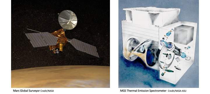
The Mars Global Surveyor spacecraft (MGS) was launched in November 1996 and completed its mission in November 2006. The Thermal Emission Spectrometer was one of 5 onboard instruments. It was a thermal infrared interferometer/spectrometer with additional broadband visible and thermal channels (bolometers).
These derived datasets span the range Ls≈104° in MY 24 to Ls≈81° in MY 27. The IR files utilize an improved retrieval for column aerosol (dust and water ice) optical depth using TES thermal IR spectra obtained in nadir viewing geometry. Compared to other published data, this approach is more physically based, allows a greater latitude range of observations to be retrieved, and enables meaningful uncertainty to be estimated for each individual retrieval.
References See user’s guide
Documentation The documentation consists of a user’s guide, a movie, and browse images.
Description of the Data
TES data were produced by the TES Science Team at Arizona State University and archived by the PDS Geosciences Node. These derived parameters are an addition to the original data set and consists of 3 data types: IR aerosol optical depth, IR aerosol optical depth maps and visible dust optical depth. The data spans 4 Martian years (M24 to M27) from 1999-02-28T21 to 2004-08-31T16 for IR data and 1999-02-28T21to 2004-08-28T08 for visible data. The user’s guide provides detailed description of the data files.
The dataset
Each data file is specified by a unique identifier (URN).The following indices are provided to aid in product selection.
IR aerosol optical depth (csv)
IR aerosol optical depth maps (csv)
Visible dust optical depth (csv)
Retrieving the data at the file level
Data can be retrieved using the URNs
Sort an index and make your selection
Upload the URN values from your revised index (note the total uncompressed file size before requesting)
Sort an index and make your selection
Upload the URN values from your revised index (note the total uncompressed file size before requesting)
Downloading the compressed data sets
| IR aerosol optical depth | IR aerosol optical depth maps | Visible dust optical depth |
Citing datasets for publication
Montabone, L et al. (2022), Mars Global Surveyor/Thermal Emission Spectrometer Atmospheric Column Dust and Water Ice Optical Depth, NASA Planetary Data System, DOI XXXXXX
 PDS: The Planetary Atmospheres Node


