- To obtain high resolution images of the Martian surface
- Characterize the structure and composition of the atmosphere and surface
- Search for evidence of life

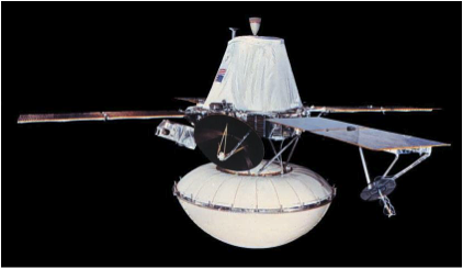
NASA's Viking Mission to Mars was composed of two spacecraft, Viking 1 and Viking 2, each consisting of an orbiter and a lander. The orbiters mapped the surface of Mars at a resolution of 150 to 300 meters. Some areas were imaged at 8 meter resolution. The landers obtained high resolution surface images and analyzed surface samples for signs of life. Weather stations and seismometers returned data.
For more information about the Viking 1 mission see the following links:
Instrument Description and Access to Data:
IRTM 15 μm, ~0.5 millibar pressure level atmospheric temperature
Mars Atmospheric Water Detector (MAWD)
Surface Temperature and Albedo (IRTM)
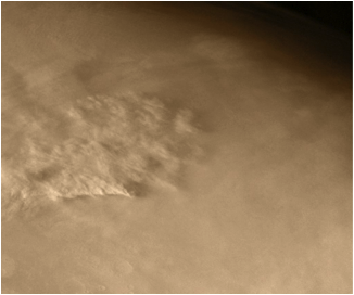
Clouds (from imaging)
Clouds (from IRTM) (map with symbols/asterisk displaying cloud locations for some interval of time) available as Latitude (2 deg) vs Ls (10 deg).
Useful Reference
Viking 1 Orbiter
Viking 1 arrived at Mars on June 19, 1976. On July 20, 1976 and , after an extensive search for a landing site, the lander touched down in Chryse Planitia (22.48° N, 49.97° W). The orbiter operated until August 17, 1980 and the lander continued until November 13, 1982.
The primary mission objectives were
For more information about the Viking 1 mission see the following links:
Instrument Description and Access to Data:
IRTM 15 μm, ~0.5 millibar pressure level atmospheric temperature
Mars Atmospheric Water Detector (MAWD)
Surface Temperature and Albedo (IRTM)
Clouds (from imaging)
Clouds (from IRTM) (map with symbols/asterisk displaying cloud locations for some interval of time) available as Latitude (2 deg) vs Ls (10 deg).
Useful Reference
"Scientific Results of the Viking Project", vol. 82, no. 28, Journal of Geophysical Res. Sept 30, 1977
 PDS: The Planetary Atmospheres Node


